We believe that all cultural, historical and natural heritage, wherever they are should be preserved. LEARN MORE
News

Default Category

Berlin’s Pergamon museum reveals new exhibit for preservation of Syria’s war-torn heritage

A New exhibition presents documents that creates the foundations for reconstruction of the city of Aleppo and other sites ruined by civil war in Syria. The efforts behind this exhibition actually started a while back by a Syrian archeologist who left Aleppo in September 2012. This was weeks before the all flights from the airport were suspended. Rami Alafandi spent the next five years in Malaysia working on a doctorate focused on the ornately decorated Ottoman-era wood panelling in 12 stately Aleppo houses. From there he went to Berlin, where his research could support preparations for the reconstruction of his homeland’s heritage.

Alafandi had taken hundreds of photographs and video footage of the Aleppine houses between 2006 and 2010. His pre-war photographs of buildings such as Beit Ghazaleh, a 17th-century house that was restored in 2009-10, actually suffered major during the war. Alafandi is now working with a team working on an initiative called Aleppo Built Heritage Documentation, a sub-division of the Syrian Heritage Archive Project, led by Berlin’s Museum of Islamic Art and the German Archaeological Institute as reported by several news outlets. An exhibition opening on 28 February, 2019 at Berlin’s Pergamonmuseum will be a major showcase for the Syrian Heritage Archive Project’s work.

The exhibition will present some of these documents, photographs along with films and interactive screens. In particular, the exhibition will be “a virtual voyage of discovery” through Syrian heritage, concentrating on the cities of Damascus and Aleppo, Palmyra, Raqqa and the so-called “dead cities”, a group of around 700 abandoned settlements in the north west.

The project which is the first of its kind is funded by the German foreign office, the Gerda Henkel Foundation and the Andrew W. Mellon Foundation. This project is the largest repository of information on Syrian heritage outside the country with more than 200,000 photographs, as well as archaeological reports, maps, plans, drawings and oral testimonies according to Stefan Weber, the director of the Museum of Islamic Art and actually a former resident of Damascus. The project which is also crowdsourced includes documents which come from researchers such as Alafandi and private and public historic archives, as well as Syrian residents and refugees. Weber says that ultimately, the Syrian Heritage Archive Project seeks to “provide a foundation for rebuilding in the future” as reported by The Art Newspaper.

At this time, the project has 15 full-time employees, nine of whom are Syrian and two half-Syrian. The team has sent data packages on heritage sites to UNESCO, including a report on the missing wooden panels at Beit Ghazaleh. The team believes that the wooden panels were removed to be sold in the international black market for heritage artifacts. This has been given to Interpol and the International Council of Museums in the hope that the panels resurface on the art market and can be returned.

The hope is that this project could be a conduit for rebuilding many Syrian sites and cities including Palmyra and Aleppo. Aleppo is in need of urgent reconstruction priority as the population and economic life return according to Stefan Weber. Aleppo which has been a World Heritage site since 1986, the city has been inhabited continually for more than 5,000 years, and was a hub on many key trade routes from the second millennium BC. Researchers believe that in the 16th century, the city was the same size as London.

In January 2018, the Syrian Directorate General of Antiquities and Museums surveyed 170 buildings and reported for UNESCO, 9% were completely destroyed and a further 24% were mainly destroyed. Weber actually compared Aleppo with Berlin after the Second World War: “It is not as bad as Berlin was in 1945, but there have been heavy losses”.

Since the European Union has established sanctions against Assad’s regime, no funding from EU has so far been allocated to the project. But some projects financed by other sources have started: the Chechen government is funding the rebuilding of the partially damaged Umayyad Mosque, one of Aleppo’s oldest and largest mosques. The Aga Khan Trust for Culture (AKTC), which maintained a limited presence in the city during the war, is helping to restore the Al-Saqatiyya souk.

• The Cultural Landscape of Syria: Preservation and Archiving in Times of War, Pergamonmuseum, Berlin, 28 February-26 May

Mysterious Stone Structures Discovered in Western Sahara

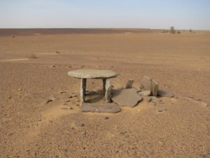
Archeologists reported recently that hundreds of stone structures dating back thousands of years have been discovered in the Western Sahara. The structures are in all sizes and shapes, and archaeologists aren’t sure what they were used for or when they were created. As reported in several news outlets, between 2002 and 2009, archaeologists worked in the field surveying the landscape and doing some excavation in the part of Western Sahara that is controlled by the Sahrawi Arab Democratic Republic. The result of their excavations and surveys has been published in a book “The Archaeology of Western Sahara: A Synthesis of Fieldwork, 2002 to 2009” (Oxbow Books, 2018).
About 75 percent of the Western Saharan territory, including most of the coastline, is controlled by Morocco, while 25 percent is controlled by the Sahrawi Arab Democratic Republic and this territory in Africa has been little explored in the past as before 1991, the two governments were in a state of war.
The archeologist state that the archaeological map of Western Sahara remains almost blank as there has been very limited amount of work done in that area. The editors of the book, Joanne Clarke, a senior lecturer at the University of East Anglia, and Nick Brooks, an independent researcher state that people living in the area know of the stone structures, and some work has been done by Spanish researchers on rock art in Western Sahara.
The stone structures are designed in a wide variety of ways. Some are shaped like crescents, others form circles, some are in straight lines, some in rectangular shapes that look like a platform; some structures consist of rocks that have been piled up into a heap. And some of the structures use a combination of these designs. For instance, one structure has a mix of straight lines, stone circles, a platform and rock piles that altogether form a complex about 2,066 feet (630 meters) long, the archaeologists noted in the book.
Though the archaeologists are unsure of the purpose of many of the structures, they said some of them may mark the location of graves. Little excavation has been done on the structures, and archaeologists have found few artifacts that can be dated using a radiocarbon method. Among the few excavated sites are two “tumuli” (heaps of rock) that contain human burials dating back around 1,500 years as reported in Live Science.
Researchers suggest that Western Sahara was once a wetter place that could sustain more animal life than it does today. Archaeologists documented rock art showing images of cattle, giraffe, oryx and Barbary sheep while environmental researchers found evidence for lakes and other water sources that dried up thousands of years ago.
Currently, there are security problems in the region and as a result fieldwork cannot go in uninterrupted and at this point has stopped. In 2013, the terrorist group al-Qaeda which operates in the desert regions near Western Sahara, kidnapped two Spanish aid workers at a refugee camp in Tindouf, Algeria, just across the border from Western Sahara. While the Sahrawi people and Sahrawi Arab Democratic Republic strongly oppose the terrorist group, it’s extremely difficult for authorities to effectively patrol the desert areas where the stone structures are located.

Discovery of Tomb with Fifty Mummies in Egypt

In the first of 2019 archeological find a joint mission between the Research Centre for Archaeological Studies of Minya University and other Egyptian archeologists unearthed a Pharaonic tomb at Tuna el-Gebel site.

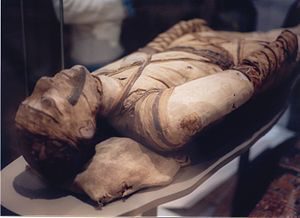
The team of archaeologists uncovered a Pharaonic tomb containing 50 mummies dating back to the Ptolemaic era (323-30BC) about 2000 years ago , in Minya, south of Cairo. The mummies, 12 of which were of children, were discovered inside four, nine-metre-deep burial chambers in the Tuna el-Gebel archaeological site. The team is still trying to decipher what the identities of the mummies were, however they stated that from the mummification method they believe that the individuals whose remains were found had to some extent held important or prestigious positions.

The Guardian newspaper which first reported on this finding also reports that visitors, including ambassadors from several countries, gathered at the discovery site where 40 of the mummies were exhibited during the announcement ceremony. Some of the mummies were found wrapped in linen while others were placed in stone coffins or wooden sarcophagi.


Archaeologists Puzzled Over Mystery Woman in Early Christian Cemetery

By Marjan Žiberna

Photograph by Arne Hodalič and Katja Bidovec

Buried beside a stunning blue glass drinking bowl, the woman may have been the first interred at the Roman site, with others eager to be near her in the afterlife.

Excavations beneath Gosposvetska Street in downtown Ljubljana revealed remains of the Roman settlement of Emona, which would eventually become the modern capital of Slovenia.

When a large construction project was launched on Gosposvetska Street in downtown Ljubljana in August 2017, Slovenian archaeologists in this ancient city naturally anticipated some interesting discoveries. But what they didn’t expect to find was an unusual glimpse into an early Christian community, and the important—and as yet unknown—woman its members chose to spend their afterlives close to.

This 1,700-year-old transparent blue glass bowl, a little more than eight inches in diameter, was found buried next to the woman at the center of the cemetery. Its Greek inscription reads: “Drink to live

The capital of this small central European country was established as the Roman settlement of Emona some 2,000 years ago, populated by thousands of colonists driven out of northern Italy by land shortages, and joined by veterans of the wars that helped to establish the Empire. From previous excavations in the area, the archaeologists knew that part of a Roman cemetery likely lay under Gosposvetska Street, and that more ancient graves would be uncovered.

More than 300 burials have been discovered beneath Gosposvetska Street, providing scientists with the opportunity to better understand how the residents of Roman Emona lived and died.

The excavations ultimately revealed a late-Roman cemetery complex containing more than 350 burials—ranging from simple graves and sarcophagi to family mausoleums—centered around the burial chapel of what appears to be a very important woman, according to Slovenian archaeologist Andrej Gaspari. The local Christian community flourished after the last major state persecution under Emperor Diocletian in the early 300s, and ended only with the destruction of Emona by the Huns in the fifth century A.D.

Only the wealthy citizens of Emona could afford to be buried in sarcophagi, which were chiseled from limestone quarried from Moravče, about 20 miles to the east.

The most stunning artifact recovered beneath Gosposvetska Street was a transparent blue glass bowl found next to the woman’s body. The 1,700-year old vessel is decorated on the outside with grapes, and vine leafs and tendrils. A Greek inscription on the inside of the bowl instructs the owner to “Drink to live forever, for many years!”

This exquisite drinking bowl could have been used in both regular daily life as well as for burial ceremonies, and an analysis of its chemical composition points to its manufacture somewhere in the eastern Mediterranean region. The grapevine decorations have their role in the Christian Eucharist and Communion, but have their origins in motifs associated with Dionysus, the pagan god of wine and ecstasy.

Archaeologists are also interested in how the woman’s tomb developed over time. It seems that possibly within a decade of her burial, her square chapel was demolished and a larger (30-by-40-foot) structure was built to enclose her tomb. Around the new structure and inside it, Emona’s Christian community began to practice a burial practice known as ad sanctos, in which the deceased are interred near the tombs of saints and other remains considered holy.

And who was the woman honored in the chapel? If archaeologists are correct that she was the first person buried in the cemetery under Gosposvetska Street and that her grave played the central role in the necropolis, she was likely a very distinguished person in Roman Emona. Her social status, religious affiliation, and place of birth, however, are only a matter of speculation for now. Planned analysis of her physical remains should hopefully answer some of those questions in the future. In the meantime, most of the valuable finds from Gosposvetska Street are now display in the treasury of the City Museum of Ljubljana.

https://www.nationalgeographic.com/culture/2019/01/mystery-woman-cemetery-ljubljana-slovenia-archaeology/

South African Archaeologists Have Rediscovered An Ancient Lost City.

The researchers – who are with the University of Witwatersrand – have been studying the site in the Suikerbosrand National Park for decades.

But it was not until cutting-edge laser technology known as LiDAR (Light Detection and Ranging) became available in recent years that they were able to study the ruins in detail from above, and discovered that what they thought was only a scattering of ancient stone huts, turned out to be a veritable city.

“LiDAR data is enabling us to do, actually to map and track what was happening in these towns, because there is no written record of them. So we’re basically rediscovering and rediscovering the use, and what this means is filling a huge historical gap especially for Southern Africa, because you know pre-colonial history of Southern Africa has no written record, so now we starting to fill in the gaps using this LiDAR technology,” said Fern Imbali Sixwanha, a PhD candidate who is part of the team studying Kweneng.

Professor Karim Sadr has been exploring the area for 30 years but says the vegetation was too thick so he commissioned a LiDAR aerial survey to get a better look.

LiDAR essentially employs lasers to measure distances to the earth’s surface which is especially useful when surveying areas with thick ground cover.

“Scanning machine that sends out laser light and basically bombards the landscape, I mean billions and billions of pulses of laser lights something like four or five hundred per square meter, just all time coming out, and as soon as each pulse hits an object, any solid object, a bird or a leaf or a tree or the ground, it reflects straight back to the machine and then the machine can figure it out where that interception took place in three dimensions. So when the plane collects all of this data, masses of it, and it comes down to ground, download the data, then they can project that data,” said Karim Sadr, professor at the School of Geography, Archaeology, and Environmental Studies at the University of Witwatersrand.

Studies now reveal that Kweneng, which spanned about 20 square kilometres, was at its prime between the 15th and 19th century.

LiDAR has also enabled archaeologists to create digital images of the 800 homesteads and other structures that housed the city’s estimated population of 10,000 Tswana-speaking people.

“If you create a game and kids can play around with the context of knowing that is the heritage and having a sense of what was been there and the sort of the housing structure and architecture which was there,” said Witness Mudzamatira, one of the researchers.

“One of the most enlightening things is, as I’ve been able to understand what we were doing in our past you know, it gives us more broader idea of the people of southern Africa who they were and the types of activities that they did because you can now rediscover that activity line and just general interaction within the society,” added Sixwanha.

Kweneng – like other Tswana city-states – is believed to have gone into decline after civil conflict.


http://www.africanews.com

International Day of Women and Girls in Science

“We need to encourage and support girls and women achieve their full potential as scientific researchers and innovators,” UN Secretary-General António Guterres said, with February 11 marking the International Day of Women and Girls in Science.

Science and gender equality are both vital for the achievement of the internationally agreed development goals, including the 2030 Agenda for Sustainable Development, the UN official website reports.

Over the past 15 years, the global community has made a lot of effort in inspiring and engaging women and girls in science. Unfortunately, women and girls continued to be excluded from participating fully in science. According to a study conducted in 14 countries, the probability for female students of graduating with a Bachelor’s degree, Master’s degree and Doctor’s degree in science-related field are 18%, 8% and 2% respectively, while the percentages of male students are 37%, 18% and 6%.

In order to achieve full and equal access to and participation in science for women and girls, and further achieve gender equality and the empowerment of women and girls, the United Nations General Assembly adopted resolution A/RES/70/212 declaring 11 February as the International Day of Women and Girls in Science.

Deceased dolphin calf in Bay of Islands

A female bottlenose dolphin is currently carrying a dead calf in the Bay of Islands and DOC staff are asking for boats on the water to give them space.

The calf, suspected to be stillborn, was first sighted on 29 January. The female is displaying strong maternal bond behaviour as is typical with marine mammals, including carrying the calf on her back and vocalising on the calf.

The mother is grieving and needs space and time to do this. The Bay of Islands is a busy place in summer with a lot of activity in and around the water. This female needs everyone on the water to give her the extra space and respect she needs whilst she copes with her loss.

If in doubt avoid all dolphin groups in the Bay of Islands,” says Dr Catherine Peters, Senior Ranger Biodiversity, DOC.

The rest of the dolphin group has at times separated from the female leaving her vulnerable. She has dropped the calf frequently as she tried to swim, and then circles back to retrieve it.

DOC has been on the water during summer as part of a public awareness campaign centred on the Bay of Islands bottlenose dolphin.

Summer is the time when most dolphins give birth. If dolphin mothers are subject to ongoing disturbance they are prevented from doing what is necessary to care for themselves and their calves.

How to approach dolphins

From a boat:

  • keep a watch for dolphins – especially around Tapeka point

  • carefully approach dolphins from their side and slightly to the rear

  • operate your boat slowly and quietly at ‘no wake’ speed within 300 m

  • don’t approach a group of dolphins if three or more boats are already within 300 m of the group

  • manoeuvre your boat carefully – do not obstruct their path, cut through a group, or separate mothers from calves

  • if you would like to observe bottlenose dolphins switch off your motor and give the animals plenty of space – this lets the dolphins carry on with important activities like nursing and catching fish. If they are not interested leave them alone

  • give dolphin mums and calves extra space

  • if you spot a dolphin less than half the size of an adult, keep your vessel 100 m away from the mother and calf

  • give bottlenose dolphins a break from all boats between 11:30 am and 1:30 pm – do not approach them during this time.

https://www.doc.govt.nz/news/media-releases/2019/deceased-dolphin-calf-in-bay-of-islands/

Italy nationalists mull refusing Da Vincis to Louvre

Italy wants to renegotiate a deal to loan all of its Leonardo da Vinci paintings to France’s Louvre to mark 500 years since his death, Italian media reported on Saturday.

Junior culture minister Lucia Bergonzoni of the far-right League told the Corriere della Sera that the terms of an agreement signed by previous culture minister Dario Franceschini were “unbelievable”.

“Leonardo is Italian, he only died in France,” Bergonzoni said of the Renaissance polymath who was born in Italy in 1452 and died in France in 1519.

“To give the Louvre all these paintings would put Italy on the margins of a major cultural event,” Bergonzoni said of the 2017 deal for the Italian state to loan all of its Da Vinci paintings to the 2019 Louvre exhibition.

“We need to discuss everything again. Where museums’ autonomy is concerned, national interest cannot come second. The French cannot have everything,” she said.

The Franco-Italian accord also provides for the Louvre — home to Da Vinci’s Mona Lisa — to loan works by another Renaissance master, Raphael, to Rome’s Scuderi del Quirinale museum for a 2020 exhibition to mark 500 years since his death.

“Most of Raphael’s works are already in Italy,” said Bergonzoni. “What’s more, Paris says that only ‘movable’ paintings can come to us, without specifying which ones.”

Bergonzoni did not immediately respond to emailed questions from AFP.

Strange carvings greeted early West Virginia explorers

By David Sibray

Images of beasts and men decorate a boulder at the Half-Moon archaeological site, now submerged beneath the Ohio River.

When pioneers and other explorers first ventured into what would become West Virginia, they encountered artifacts of a much earlier age — carvings, burial mounds, and stone walls, the origins of which natives could not explain with certainty.

Petroglyphs inscribed in rock and featuring human and animal figures were perhaps the most striking and inexplicable finds. Mounds and earthworks could be practically accounted for as defensive or monumental — but carvings? They were certainly communications.

With whom were the creators attempting to communicate and why? Were the carvings inspired by ritual or sheerly as human expression?

Archaeologists can only speculate. Without written records, we may never know with certainty.

Scholars have, however, begun to piece together the larger story of life here before written record, thanks to artifacts that remain — carvings, earthworks, and common relics such as arrowheads and shards of pottery.

Some of the most extensively carved rocks, we now know, were located in river valleys, along which many prehistoric settlements were located. Most are long gone, though others are protected by archaeologists who will not reveal their locations.

Some have been destroyed and incorporated into new construction. Others were drowned when rivers such as the Ohio, Kanawha, and Monongahela were locked and dammed for navigation. Detail from Half Moon archaeological site showing human and animal figures.

One of the northernmost of these “Ancient Monuments” in West Virginia is now located under water along the Ohio River in the Maryland Heights neighborhood of Weirton, West Virginia.

The Half-Moon Site, as the monument is known today, was surveyed in 1838 by James McBride — long after its discovery by European explorers. His account was published in 1847 in Squier and Davis’s “Ancient Monuments of the Mississippi Valley,” which was later reviewed by the Ohio Historical Society, republished in the West Virginia Archaeologist in 1978.

“July 4, 1838. When making a survey of a turnpike road up the Ohio River, on the of the (sic) third of July 1838 in the evening encamped on the farm of Mr. Ephraim Cable four miles above Steubenville. On the next morning July 4th accompanied by John W. Erwin, Civil Enginer (sic), crossed the Ohio river to the Virginia side, for the purpose of examining a rock which we were informed was on that side.”

“We found the rock lying on the Virginia side of the river. It lies about three feet above low water mark, having a flat surface of about nine feet by seven inclining a little toward the water. It is of hard sand stone, and all over the surface are various figures cut and sunk into the hard rock, amongst these figures are rude representations of the human form, tracts (sic) of human feet representing the bare foot and print of the toes as if made in soft mud, tracts of horses, turkeys, and a rabbit. Several figures of snakes, a tortois (sic), and other figures not understood. A drawing of them was made on the spot by Mr. Erwin as here represented.

“There are a number of other rocks lying on the shore both above and below the one on which the figures are cut, which appear as though they had at some former period rolled down from the hill above. Below this rock is one of much larger size, being about twenty feet in diameter, with a flat surface inclining up stream, on which are several deep cuts or the remains of figures, with which the rock may have been covered; but owing to its exposed situation the current of the river, ice and other floating substances have worn the face of the rock and defaced the figures upon it.”

James L. Murphy, of the Ohio Historical Society, noted in his review of McBride’s survey that the sketch of the rock and petroglyphs was likely inaccurate, though that criticism did not devalue the find.

“It seems clear from McBride’s description that Squier and Davis’ drawing is also inaccurate in portraying the petroglyphs as lying on an upright, monument-like slab of sandstone, for McBride clearly states that the rock had a flat surface “inclining a little towards the water.” Probably the other discrepancies between McBride’s drawing and that of Squier and Davis’ are also due to artistic licences or carelessness on the part of the engraver.

Perhaps not surprisingly, the Half-Moon rock is only one of many archaeological sites that did and do exist elsewhere in the Ohio Valley near Weirton and elsewhere in West Virginia.

Read also: Geologic anomaly visible only from space; Ghostly rumble tied to underground source

Do you think you’ve found an archaeological site in West Virginia? Many such sites have been cataloged though they’re their locations have not been publicized. In this way archaeologists can help protect them. Such delicate, finite resources are best explored by trained investigators.

If you think you’ve found an archaeological landmark or relic, contact the the W.Va. Division of Culture and History at 304-558-0220.

Interested in supporting or finding out more about archaeology in West Virginia. Contact the West Virginia Archaeological Society or the Council for West Virginia Archaeology.

https://wvexplorer.com/2019/01/12/strange-carvings-greeted-west-virginia-explorers/

In Memory of the Victims of the Holocaust

Memory of the Victims of the Holocaust
International Day of Commemoration in Memory of the Victims of the Holocaust. It also
commemorates when the Soviet troops liberated the Nazi concentration and death camp Auschwitz-Birkenau in Poland on January 27, 1945.
January 27 is a special day to remember World War II’s holocaust victims.
Background 
The Holocaust, or Shoah (Sho, Shoa), is the term used to describe the deliberate
murder and desecration of millions of people prior to and during World War II in
Germany and German occupied areas in Europe. Many of them were Jewish but the
Roma people, Soviet civilians and prisoners of war, ethnic Poles, people with disabilities, homosexuals and political and religious opponents were also killed. Many people died in concentration and death camps spread across Nazi-occupied Europe. One of the most notorious camps was Auschwitz-Birkenau, near Oświęcim, Poland. More than one million people died in Auschwitz-Birkenau before Soviet troops liberated it on January 27, 1945.
On January 24, 2005, the UN General Assembly commemorated the 60th anniversary of the liberation of the Nazi concentration camps. Following this session, a UN resolution was drafted to designate January 27 as the International Day of Commemoration in Memory of the Victims of the Holocaust. The resolution called for education programs on the Holocaust to help prevent genocide. It also rejected denials that the Holocaust occurred. On November 1, 2005, the assembly adopted this resolution so the day could be observed each year. It was first observed on January 27, 2006.
Many Jewish groups, particularly in Israel, also observe Yom HaShoah , which is a day of mourning for Holocaust victims on 27th day of the Hebrew month of Nisan, which falls in April or May of the Gregorian calendar.

What Do People Do?
Holocaust survivors and various leaders make their voices heard on the International Day of Commemoration in Memory of the Victims of the Holocaust. Many of them speak
publicly about the Holocaust or their experiences around the event, its aftermath and why the world should never forget what happened in Europe in the 1930s and 1940s. Many statements emphasize the need for future generations to learn about and remember the Holocaust and for everyone to work towards preventing genocide.

The UN organizes and supports events such as: concerts by musicians who survived the Holocaust or are survivors’ descendants; art exhibitions influenced by the Holocaust;  presentations of special stamps; the introduction of special educational programs; and film screening and book signing focused on the Holocaust.
Israel and many countries in Europe and North America mark the International Day of
Commemoration in Memory of the Victims of the Holocaust. Many academics present
discussion papers or hold seminars or round table discussions on the Holocaust and its
legacy in the modern world. Schools or colleges may also have special lessons on the
Holocaust. The Holocaust and how people commemorate it receive special attention on
the Internet, television, radio, print media.